Mark posts with this category that are designated for the self guided walks page.

Long & Ell Pond – Hopkinton, RI

Long and Ell Ponds Natural Area in Hopkinton – Bruce Fellman

WildforaRI, Fall 2021

The mantra among real estate professionals is, of course, “location, location, location,” and this phrase was certainly ringing loud and clear as my wife and I looked over the small ranch house in Hopkinton in 1978 that we’d soon decide to buy. To be sure, all the usual inducements — decent schools, good construction, and a nice neighborhood — played a role in our decision-making, but for me, the ultimate tipping point was this: the house was right down the rural road from a natural paradise known as the Long and Ell Pond preserves.

Ell Pond, BFellman

I’d first started to trek the area’s rugged trails, which many hikers regard as the most challenging in Rhode Island, in the late 1960s, when I discovered that rumors about Long Pond’s reputation as a clothing-optional swimming hole were delightfully true. (Yes, I often took the plunge in the altogether.) Several years later, on an excursion with the venerated University of Rhode Island plant scientist Elmer Palmatier as part of his legendary Field Botany course, I set an uneasy foot on Ell Pond’s quaking bog, that thick fringe of sphagnum moss and other acid-loving vegetation that could miraculously support the weight of a budding naturalist.

Since those halcyon days and occasional nights, I’ve lost track of how many times I’ve explored the area, which continues to call to me, despite the fact that we outgrew the house and moved to Connecticut four decades ago; swimming, suited or not, has long been banned; and the quaking bog has, like its chief supporter, passed into history. (Elmer departed this earth in 1995.) But if you’re physically up to it — I’ve seen nimble youngsters and their folks and grandparents navigating the time- worn boulders and wooden stair steps, many of which are lovingly crafted and maintained by the RI chapter of the Appalachian Mountain Club — you won’t find a more stunning or intriguing botanical venue in the state.

Long Pond, BFellman

One of the chief attractions of the Long and Ell Ponds Natural Area (LEPNA), which is managed by The Nature Conservancy, the Audubon Society of Rhode Island, and the RI Department of Environmental Management, is a highly unusual lowland forest dominated by native great rosebay rhododendron (Rhododendron maximum) and mountain laurel (Kalmia latifolia). While both species are common enough along the state’s byways and in many gardens, there’s something about Long and Ell’s highly acidic rocky soil and moisture regime, to say nothing of its persistent isolation from development, that has enabled the Hopkinton venue to provide a refuge for a profusion of evergreens that call to mind the slopes of the Appalachian highlands rather than the typical woods of the Ocean State.

Probably the best time to visit LEPNA is when the target plants are in bloom: early-to-mid June for the laurels, late June to early July for R. maximum. They don’t put on a show every year, but even an off-display is worth the trek, and when the blossoms are abundant, as the laurels were in 2021 — I   can’t vouch for the “rhodies” this past year, since I was, at the time, still too hobbled from surgery to make the trip — the sight and delicate scents of the bee-laden flowers is grist for the memory mill.

Nor are these evergreens the only plants worth noticing. As you search for good handholds among well-worn rocks and boot-polished exposed tree roots, the exercise makes you slow down and pay closer attention to the landscape. In short order, you begin noticing things you might have missed, among them an abundance of mushrooms, lichens, and mosses.

As the trail climbs towards higher and drier spots, the broad-leafed plants give way to mountain chestnut oak (Quercus montana) and scrub oak (Quercus ilicifolia), as well as pitch pine (Pinus rigida), species that can fare well on the moisture-challenged rocky slopes. In other parched spots, I noticed patches of trailing arbutus (Epigaea repens), eastern spicy wintergreen (Gaultheria procumbens) and a wand-flowered goldenrod (Solidago spp.) that I wish I could have collected to determine its precise identity. (Bring field guides or have a plant photo ID app on your phone —collecting is definitely not encouraged.)

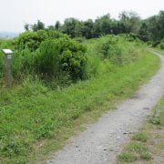
At approximately the height of land, the main trail presents the hiker with three choices. To the east is a short descent to a massive rock outcrop that offers stunning views of Long Pond and the surrounding forest. Stay on the main trail to pick your way down an impressive gorge and make a formidable trek around Long Pond that botanically offers a repeat of what the observer has already seen. (Unless you’ve brought a second car, this walk also demands either turning around at the DEM parking  area   and retracing  your steps back to the North Road trailhead or hiking  a  series  of  dusty  backwoods roads to return to your vehicle.)

For plant aficionados, however, the best option is to take the fork that leads west to Ell Pond. Officially, the trail ends on a large rocky hill, technically termed a monadnock, marked with a National Park Service plaque noting that in 1974  Ell Pond was designated a National Natural Landmark. Geologists have determined that Ell, which is increasingly obscured by trees, is a “kettle pond,” a body of water that formed when huge blocks of ice left behind more than 10,000 years ago by retreating glaciers melted and filled in deep, glacier-carved gouges in the landscape.

Sundew, BFellman

There’s no path to the pond, but I’ve been there and can report that the area is a spongy wonderland dominated by Atlantic white cedar (Chamaecyparis thyoides), an increasingly rare species that forms the core of a globally threatened wetlands ecosystem. The quaking bog that once fringed the shoreline is no longer intact but the acid soil on the edge of the pond still provides a welcoming environment for charismatic botanical carnivores such as purple pitcher plant (Sarracenia purpurea) and round-leaved sundew (Drosera rotundifolia), along with a host of intriguing wet-feet specialists, such as the Massachusetts fern (Parathelypteris simulata), swamp loosestrife (Decodon verticillatus), common arrowhead (Sagittaria latifolia), and various cranberries (Vaccinium spp.)

 But look quick. Ell, like many kettle ponds, is in the process of filling in and becoming a wet meadow. While climate change will no doubt exacerbate the inevitable stages of succession, there’s still at least a little bit of time to savor this well-preserved slice of botanical intrigue. Just don’t count on a swim.

image of the boardwalk at Dundery Brook Trail

John C. Whitehead Preserve – Dundery Brook Trail System, Little Compton, RI

A walk revisiting the original and newer section of the Dundery Brook Trail — Dick Fisher & John Berg
WildfloraRI, Spring 2021

image of the boardwalk at Dundery Brook Trail

Boardwalk at Dundery Trail, photo JDetz

The John C. Whitehead Preserve, owned by The Nature Conservancy, was formed by combining the Bumble Bee Preserve with contiguous land to the west. The combined area preserves 130 acres of pristine freshwater wetlands, which drains via Dundery Brook into Briggs Marsh on its way to the ocean. The trail system is composed of three arms, each about 0.6 miles long, which meet in the middle forming a star shaped pattern.

Located in Little Compton, the area can be accessed by two trailheads. The newest is located along West Main Road (Route 177) 1.3 miles south of Peckham Road (Google Driving Directions), and a second, the original trailhead, is behind the tennis courts in the Little Compton Commons (Google Driving Directions). The trailheads are marked and parking is available at both.

In the Winter 2011 issue of WildFlora available on the RIWPS website, the ‘Dundery Brook Trail’ article describes the original two trail sections—Dundery Brook Trail and Blanche’s Path. The new trail system combines the two sections described in that article and adds Hope’s Path, which opened in 2019. The trails traverse hardwood forest wetlands with interspersed lowland meadows. The area is flat and the wetland portions of the trails are elevated to allow year-round comfortable access.

The Dundery Brook arm is built entirely on an elevated boardwalk set on steel posts and is wheelchair accessible. There are benches for sitting along this stretch. The newest arm, Hope’s Path, wanders by a collection of ponds initially and then enters the wetland forest where informal board bridges provide dry walking. This trail is wide and well-marked but not as disability friendly as the Dundery portion.

The third arm of the star, Blanche’s Path, begins where the boardwalk ends and extends through low meadowland as it skirts around Bumble Bee Pond and into the meadow beyond. This portion is historic farmland which is grown over with succession vegetation. Bumble Bee Pond was created as a water source for grazing but now contains a vigorous colony of cattails (Typha latifolia) and is a resource area for bird and aquatic life.

Asclepius Incantata. photo GGarnder

Entering through the new west entrance one encounters a flurry of typical invasive species, but these soon wane, as the trail meanders through open meadows weaving around about a half dozen ponds. In early fall of a very dry year, 2020, the water levels were low in most ponds, but the lily pads (Nymphaea odorata) were blooming and the frogs and dragonflies abundant. The pond margins attract the invasive common reed (Phragmites australis) and cattails (Typha latifolia), but there is plenty of open water and cleared space to reach the water’s edge.

The meadow areas contain the usual fall blooming meadow species such as spotted Joe-Pye weed (Eutrochium maculatum), boneset (Eupatorium ssp), several species of goldenrod (Solidago ssp), swamp milkweed (Asclepias incarnata) common milkweed (Asclepias syriaca), and numerous aster species.

Lobelia cardinalis (cardinal-flower), photo GGardner

As the meadows end, the trail dips into the wet woodlands and is enclosed by abundant understory plants as well as the taller hardwoods. Ferns line this section along with sweet pepperbush (Clethra alnifolia), highbush blueberry (Vaccinium corymbosum), winterberry (Ilex verticillata), willows (Salix ssp), and scattered fall-blooming wildflowers such as cardinal flower (Lobelia cardinalis) and wood aster (Eurybia divaricata).

The trail crosses Dundery Brook on an historic granite slab bridge, then meanders through several open bog areas filled with grasses and sedges as the route gradually climbs slightly to meet the Dundery Brook boardwalk portion of the trail. This area is slightly dryer with a more open understory covered with dwarf raspberry (Rubus pubescens) and flat-branched tree-clubmoss (Dendrolycopodium obscurum).

From this central point, the Dundery Brook Trail to the south (right) on the boardwalk leads to the trailhead at the Commons. It winds through a wetland hardwood forest crossing streams and shrub meadows. From the intersection of Hope’s Path and the Dundery Brook Trail, Blanche’s Path proceeds to the north (left) remaining on the boardwalk for one hundred feet or so. It then becomes a grassy trail around Bumble Bee Pond and open meadow beyond.

The plants here are dominant species that define the habitat of the coastal oak-holly forest and wetlands. But many more are present. An inventory completed a few years ago documented more than 350 plant species in the Preserve, and undoubtedly more exist. The special access that the elevated trails provide allows a close look at this wetland plant community. The Dundery Brook Trail system is also a unique place for quiet reflection.

Parris Brook – Mount Tom Trail, Exeter, RI

A Walk Along Parris Brook on the Mount Tom Trail – Marnie Lacouture
WildfloraRI, Winter 2020

The Mount Tom Trail in Exeter, with almost six miles of varied hiking experiences, is perhaps best known for the panoramic views from its high point south of Route 165. I like to wander at a snail’s pace, however, along Parris Brook, a short botanically rewarding section of the trail. The heady smell of grapes greeted me on a bright September morning last fall as I left my car in the small clearing that accommodates a few parked cars, just before the bridge on Mount Tom Road. An occasional hiker, dog walker, or fisherman may share the area, but usually it is quiet except for the splashing of water over small dams of rocks and logs created by fishermen, according to the late Ken Weber in his book Walks and Rambles in Rhode Island. Depending on the season there may also be bird calls or the buzz of insects. Years ago, an elderly woman told me how she and her husband had crouched safely in the brook under a wet tarp during the forest fire of 1951 that destroyed their nearby cabin.

Witchhazel on the Parris Brook section of the King Tom Trail

fall-blooming American witch-hazel (Hamamelis virginiana), MLacoulture

Heading southeast on the trail I first found the tiered seed pods of American hornbeam (Carpinus caroliniana), hanging from branches like dangly earrings. Farther along, more branches interwove with those of American witch-hazel (Hamamelis virginiana), their yellow spidery blossoms beginning to open, and the sun created a shining ceiling of pods and flowers against the blue sky. It had been a good summer for poison-ivy (Toxicodendron radicans), with leaves so large they looked like tropical vines climbing on nearby trees. Along the road, its cut-back stems were sturdy and short with large white berries that birds and even deer eat. Tall meadow-rue (Thalictrum pubescens) had had a good growing season too, and what remained were six to eight feet stalks. Giant pitch pines (Pinus rigida), with rough mosaic-patterned bark, stood tall and straight next to eastern white pines (Pinus strobus), while red maples (Acer rubrum), arched over the water, were beginning to show color. The thick, green vegetation mostly obscured the brook except where fishermen had kept a few paths to the water open.

As I looked closely, I began to sort out the various colors and shapes of the leaves—there was nannyberry (Viburnum lentago), its raisin-like fruit so far undiscovered by birds, and clammy azalea (Rhododendron viscosum) with fat seed pods and plump buds promising fragrant June flowers. There was an occasional clump of Canadian serviceberry (Amelanchier canadensis), the waxy green of mountain laurel leaves (Kalmia latifolia), and common winterberry (Ilex verticillata), their leaves curled and black from apparent insect damage. Though one large branch, partially broken and hanging in the water, had perfect green leaves and lots of bright red berries. Coastal sweet-pepperbush (Clethra alnifolia) grew everywhere, the brown seed pods standing above the branches like spires, reminders of its abundance of fragrant blooms in early summer.

On the ground were the remnants of spring-blooming wildflowers, groups of sessile-leaved bellwort (Uvularia sessilifolia), beginning to shrivel and yellow, and the two basal, striped-veined leaves of pink lady’s-slipper (Cypripedium acaule) hugging the earth. Some carried a brown seed pod with a bird-like beak at the top of a tall, erect stem, reminding me of herons. Remnants of a carpet of Canada-mayflower (Maianthemum canadense) offered a few red berries for hungry birds. The true ephemerals of spring, such as wood anemone (Anemone quinquefolia) and dwarf ginseng (Panax trifolius), were left to the imagination.

Eutrochium-maculatum-spotted-Joe-Pye-weed-moth

Eutrochium-maculatum-spotted-Joe-Pye-weed-moth, DMcGrady

Late-summer bloomers were abundant. Along the bank grew spotted Joe-Pye weed (Eutrochium maculatum), cardinal flower (Lobelia cardinalis) and axillary goldenrod (Solidago caesia) amid royal ferns (Osmunda regalis) and the activity of dragonflies. Along the trail bloomed white wood aster (Eurybia divaricata), heath American-aster (Symphyotricum ericoides) and the only white goldenrod (Solidago bicolor).

At my feet were the unassuming evergreens that become apparent as the deciduous plants lose their leaves; they would soon be especially welcome as winter companions. Great masses of partridge-berry (Mitchella repens) carpeted the bank, its fruit already a cheerful bright red, and small clumps of trailing arbutus (Epigaea repens) dotted the edge of the trail, the seeds planted unwittingly by nesting ants. Another of its common names is mayflower, since the Pilgrims were cheered by its lovely bloom their first spring in America. On the edge of Mount Tom Road, near the trail, arbutus covers much of the bank in April. It is well worth a visit to see and smell the tiny blossoms attended by early pollinators. The shiny round leaves of American wintergreen (Pyrola americana) and the striped leaves of pipsissewa (Chimaphila maculata) were crowded among common lowbush blueberries (Vaccinium angustifolium). Mosses and clubmosses would add to the winter greenery.

When I reached the bridge over Parris Brook on Blitzkrieg Trail, I turned and retraced my steps. Instead you can cross Blitzkrieg Trail into the pine/oak forest for a longer walk to the Wood River and beyond or head northwest up the Mount Tom Trail from the parking area for a more rigorous hike over granite outcroppings. I would save those hikes for another day but promised myself to return soon to this ever changing trail, rewarding in all seasons.

Directions to the pull over parking area for this walk

Note: This walk is only a very short section of the Mt Tom Trail going east between Mt Tom Rd. and Blitzkrieg Trail. From the parking pull over head in the direction of the brook (downriver) on the same side of the of the road as the parking spots.  


Haile Farm Preserve, Warren RI

On the Trail – Garry Plunkett
WildforaRI, Spring 2020

Haile Farm’s historical narrative is a common one for coastal Rhode Island. A European family settled along rich coastal marshlands and raised livestock with hay from the salt meadows, supplemented by English hay planted on their upland meadows. The farm endured changing times into the 20th century when development slowly surrounded it. But there is a happy ending to this farm’s story because the Warren Land Conservation Trust has protected 61 acres of the original farm, including critically important estuarine and forested wetland habitats.

The preserve is off Route 136 in a busy commercial area, so a first-time visitor may need multiple GPS checks while weaving through warehouses and industrial construction to find the trailhead. The hike begins on a path rife with invasive plants, Bradford pear (Pyrus calleryana), Asian bittersweet (Celastrus orbiculatus), autumn-olive (Elaeagnus umbellate), mugwort (Artemisia vulgaris), and Morrow’s honeysuckle (Lonicera morrowii). It’s a familiar suite of despicables. But, like human relationships, first impressions can hide deeper meaningful qualities, and there is much to admire at Haile Farm behind this front door. The vegetation soon transitions to early successional woodland with a typical thicket of shrubs and pioneer trees such as quaking aspen (Populus tremuloides) and gray birch (Betula populifolia). But the careful observer might notice an unusual species, a scattered stand of trees that are rogue to Rhode Island–boxelder (Acer negundo).

Boxelder is common almost everywhere in the Eastern U.S., except New England. Sometimes considered a weedy pest, it evolved as a flood plain tree, stabilizing soil on stream banks alongside other fast-growing species, silver maple (Acer saccharinum) and green ash (Fraxinus pennsylvanica). Once used for box-making, its leaf resembles that of our common elderberry, hence its name. Another common name is more appropriate–ash-leaf maple. It is indeed a maple tree, with typical helicopter-wing samara seeds, but with ash-like compound leaves.

Beyond the boxelder stand is a large pond on the right, residue from aborted development, but perhaps someday it will be a lovely aquatic system. A left turn at this point puts one on a green loop trail leading to the Palmer River estuary. This is where the upland woods change to a maritime shrubland transitional cover, then salt marsh. Like all ecotones, this one is rich in plant diversity, ideal for field botanists keying out species. Enter Doug McGrady, the Society’s plant wizard. Doug has compiled a comprehensive inventory of Haile Farm Preserve plants, and many interesting ones are in this area–ragged thoroughwort (Eupatorium pilosum), bushy bluestem (Andropogon glomeratus), yellow thistle (Cirsium horridulum), and white-fringed bog-orchid (Platanthera blephariglottis), the last two being state-threatened species.

The trail then winds through the shrubland to an opening where one’s vision is bathed in a wide-screen spectacle, birds winging across open skies over the salt marsh’s tawny blanket. And, as if fashioned by an artist, a lovely backdrop is formed by a “peninsula” of trees reaching out to the shoreline. A spur trail on this spit of upland leads across the marsh where one can be in a dry, oak-hickory barren, but with salt marsh nearby on two sides. The spur ends at the water’s edge where tidal zone plants can be explored, including maritime marsh-elder (Iva frutescens), American sea-rocket (Cakile edentula), sweet-scented camphorweed (Pluchea odorata), Carolina sea-lavender (Limonium carolinianum), and species glassworts (Salicornia spp.).

Backtracking to the green loop, it quickly intercepts a yellow mini-loop trail. This short sidetrack weaves under a power-line easement with another distinct plant community. Recent studies attribute significant environmental value to clear-cutting small areas within a mature forest. Resurgent growth in these “patch cuts” provides important habitat for many species under threat, notably woodland nesting neotropical songbirds. The studies consistently show that patch cutting in mature forests increases the number of woodland bird species, as well as the survival of their fledglings. Since National Grid periodically cuts trees in this easement, it serves as a perpetual patch habitat.

This patch features plants adapted to open, dry forest clearings such as sheep-laurel (Kalmia angustifolia), sweet-fern (Comptonia peregrina), little bluestem (Schizachyrium scoparium), switch panicgrass (Panicum virgatum), black huckleberry (Gaylussacia baccata), and early successional trees, eastern red cedar (Juniperus virginiana), scrub oak (Quercus ilicifolia), gray birch (B. populifolia), and pitch pine (P. rigida).

Returning to the green loop, it enters a mature conifer-hardwood forest that is a jewel of the preserve. It’s also a splendid place to let one’s mind wander back in time, imagining what could have been two hundred years ago. The terrain is flat, lush, and relatively free of surface stones which probably were long ago put into stone walls now crisscrossing the woods. During the early days of Haile Farm this area may have been a fresh meadow, a moist plain along a stream that was ideal for the European cool season grasses planted by settlers. One can imagine a harvest crew rhythmically swinging scythes, slowly mowing their way across this meadow, laying up English hay for winter forage.

Judging from the tree sizes, haying or pasturing probably stopped about 100 years ago, after which natural succession slowly brought back a southern New England temperate forest. Henry David Thoreau was the first to observe and document this process, recording in his journal a pattern of changing vegetation on abandoned fields around Concord.

Successional dynamics have been exquisitely successful on this part of Haile Farm, producing a handsome canopy of oaks, tupelos, sassafras, hickories, and swamp maples that cover a diverse, multi-layered understory–chest-high cinnamon fern (Osmundastrum cinnamomeum), thickets of aromatic coastal sweet pepperbush (Clethra alnifolia), eastern shadbush (Amelanchier canadensis), and hazelnut, both American (Corylus americana) and beaked (C. cornuta). Wildflowers on the forest floor add color, including brilliant red cardinal-flower (Lobelia cardinalis) on a streamlet crossing the trail, soft hues of pink lady’s-slipper (Cypripedium acaule), and a delicate yellow of sessile-leaved bellwort (Uvularia sessilifolia). Meandering in the shade of this beautiful woodland is the perfect ending to a walk at Haile Farm.

As a newly preserved property, it is still rough around the edges. But progress is everywhere–removing invasive plants, installing bog bridges, and flagging new sections of trail. This should not deter you from sampling its varied habitats. Print the trail map from the Warren Land Conservation Trust website, as paper copies are not yet available at the trailhead kiosk. The trail described here is an easy 1.3-mile walk on flat terrain.

Like a well-written novel, Haile Farm’s drama builds slowly, but there is much to excite a broad range of interests, history, botany, ecology, or archeology. It’s also a great place to just “slip into something comfortable,” that is to say, be alone in the quiet of nature, gather thoughts, and recharge.


Malcolm Grant Trail, Narragansett, RI

On the Trail – Laura Orabone
WildforaRI, Spring 2018

Rhode Island boasts some 400 miles of splendid coastal habitat, and the Malcolm Grant Trail in Narragansett is a perfect way to spend a day getting acquainted with it. Dedicated in 2008 and named for a long-time official with the RI Department of Environmental Management, in “recognition for his participation in acquisition of Black Point for the citizens of Rhode Island and his advocacy of ADA access and this trail to the shore,” this grassy trail winds through dramatic, windswept headlands overlooking the Atlantic Ocean and up into Narragansett Bay.

View of the main trail from the parking lot

Begin your exploration of this approximately four-mile trail system in the Black Point Fishing Area parking lot, directly across from 655 Ocean Road. From here you can follow the main trail south through a variety of maritime biomes, including woodlands, shrublands, and rocky cliffs, before reaching its terminus at the northern edge of Scarborough State Beach. A shorter loop trail, dedicated in 2012, winds to the north and offers some fine views of the bay.

The main trail begins by guiding you toward the coastline through grassy maritime shrubland. The habitat here is anchored by clumps of small trees and shrubs, including winged sumac (Rhus copallinum), arrowwood (Viburnum dentatum), black elderberry (Sambucus nigra), black cherry (Prunus serotina), and fragrant small bayberry (Morella caroliniensis). American pokeweed (Phytolacca americana) with its bright purple berries, the torch-like stalks of mullein (Verbascum thapsus), and the fuzzy leaves of burdock (Arctium minus) are a common sight. Often these anchor trees and shrubs are draped—some might even say choked— with a variety of climbers, both native and invasive. Wild rose (both Rosa rugosa and R. virginiana), greenbriar (Smilax glauca), wild grape (Vitis labrusca), and the common groundnut (Apios americana) weave themselves through strands of climbing nightshade (Solanum dulcamara), bramble canes (Rubus sp.), Virginia creeper (Parthenocissus quinquefolia), and poison ivy (Toxicodendron radicans). Needless to say, a degree of care must be taken during blackberry season.

As the trail continues, you will notice an abundance of coastal wildflowers, offering beauty to the eye as well as habitat to local wildlife. White avens (Geum canadense) and broad-leaved enchanter’s-nightshade (Circaea canadensis) jostle with showy Turk’s cap lilies (Lilium superbum) and coastal plain Joe-Pye weed (Eutrochium dubium). Delicate jewelweed blossoms (Impatiens capensis), fluffy white meadowsweet (Spireae alba), and cheerful ox-eye daisies (Leucanthemum vulgare) sway over scattered constellations of Deptford pinks (Dianthus armeria). The rich greens of sensitive fern (Onoclea sensibilis) and cinnamon fern (Osmundastrum cinnamomeum) offer a pleasing contrast to a variety of pale grasses, including velvet grass (Holcus lanatus), redtop (Agrostis gigantea), prairie cord grass (Spartina pectinata), and Timothy grass (Phleum pratense).

A number of side trails peel off from the main path, offering plenty of opportunities to wander and explore. Some lead back inland, toward the woodlands along the road, taking you through scrubby, disturbed areas of fireweed (Chamerion spp.), grape (Vitis spp.), Japanese knotweed (Fallopia japonica), hay-scented fern (Dennstaedtia spp.), and dewberry (Rubus flagellaris) before you reach the woodlands. Eastern red cedar (Juniperus virginiana), Norway spruce (Picea abies), shadbush (Amelanchier spp.), sassafras (Sassafras albidum), and black and scarlet oaks (Quercus spp.) dominate here, providing shade, wildlife habitat and a welcome screen from summer traffic noise.

Many plants along the shore

Other side trails allow you to scramble down rocky cliffs, climb huge glacial erratics, and explore tide pools along the water’s edge at low tide. On a clear day, both the Point Judith and Beavertail lighthouses are visible in the far distance. You are now venturing into the maritime rocky cliff community. Here you encounter salt-tolerant coastal plants such as beach pea (Lathyrus japonicus), seaside plantain (Plantago maritima), orache (Atriplex spp.), black mustard (Brassica nigra), scarlet pimpernel (Lysimachia arvensis), and seaside goldenrod (Solidago sempervirens), which can be found nearly to the tide line, tucked between cracks in the rocks. Take care to watch your footing along here—the rocks below the tide line can be quite slippery, and the path becomes muddy after rain. The black rocks just offshore mark a popular fishing spot, but please resist the urge to explore them, as several people have slipped and drowned in this area.

Looking south toward Scarborough Beach

The southern end of the trail brings you to Scarborough State Beach and the ruins of an old stone carriage house that belonged to one of the many large estates that once dominated the coastline. Some say it was destroyed by fire; others blame the infamous hurricane of ‘38. Its remains are now slowly succumbing to the ravages of time, the weather, and bored young people. Nonetheless, it provides a pleasant spot to rest and enjoy a sunset.

Directions: Park in the gravel lot directly across from 655 Ocean Road, just north of Scarborough State Beach. A sign marks the parking lot as Black Point Fishing Area. A walking stick is a handy thing, especially on uneven or slippery terrain. Special thanks to Hope Leeson, botanist for the Rhode Island Natural History Survey, for her assistance in coastal plant identification.

Photos by Laura Orabone

Francis C. Carter Memorial Preserve, Charlestown, RI

On the Trail – Laura Orabone
WildforaRI, Winter 2017 

The Francis C. Carter Memorial Preserve, located in Charlestown, is Rhode Island’s second-largest nature preserve and is maintained by the state’s chapter of The Nature Conservancy. This 1,112- acre property was acquired in 2001 with help from The Champlin Foundations, the Doris Duke Charitable Foundation, and the Cove Point Foundation. The preserve is dedicated to Francis (“Frank”) C. Carter, who led the Champlin Foundations for many years.

The preserve encompasses an 11-mile corridor of open space between the glacial moraines of the Ninigret National Wildlife Refuge to the mixed eastern woodlands and grasslands of the state-owned Carolina Management Area. It is easily accessible from two locations: one at its eastern edge off Rte. 112 (also called Carolina Back Road) and another to the west off Old Mill Road. Originally offering more than five miles of well-marked trails, it has recently been expanded; however, since the new trails have yet to be included on official maps of the property, this guide will cover only the original trails.

The Old Mill Road entrance provides two parking areas – one near the trailhead for cars and another large enough to accommodate horse trailers and a manual pump for watering horses. Note that the gravel road leading to the parking area is not always well-graded. Equestrian trails are marked. Near this parking area, and throughout the preserve, you can find pink lady slipper orchids (Cypripedium acaule) in early spring. The ruins of a cellar hole are barely visible to the left, just past the trailhead.

From this entrance, the Narragansett Trail takes visitors through stands of mountain laurel (Kalmia latifolia), sheep laurel (Kalmia angustifolia), black birch (Betula lenta), bracken fern (Pteridium aquilinum), mockernut hickory (Carya tomentosa), white oak (Quercus alba), white wood aster (Aster divaricatus), and eastern white pine (Pinus strobus). Other notable native plants include pipsissewa (Chimaphila umbellata), spotted wintergreen (Chimaphila maculata), and partridge berry (Mitchella repens).

The Narragansett Trail provides an easy walk to a 35-acre grassland surrounded by pitch pine and quaking aspen. This area, cleared in 2008 with the cooperation of The Nature Conservancy, The National Audubon Society, and the Rhode Island Department of Environmental Management, was recently expanded. It provides an important example of early successional habitat. Here you can see goldenrods, common milkweed (Asclepias syriaca), bayberry (Myrica pensylvanica), and a variety of native grasses and sedges. The adjacent uplands feature scarlet oak (Quercus coccinea), white oak (Quercus alba), pitch pine (Pinus rigida), and high-bush blueberry (Vaccinium corymbosum).

On warm spring evenings, when the peepers are in full swing, you can watch woodcocks performing their aerial courtship displays. The area also provides a nesting area for the state-threatened grasshopper sparrow, as well as the eastern towhee, scarlet tanager, and prairie warbler. American kestrels, brown thrashers, blue-winged warblers, and dozens of other birds may be observed here. A complete list is provided at the trailhead.

Off the Narragansett Trail is the short White Trail loop on the right. Before you reach the field, you can take a trail to the left leading through mostly pitch and white pine woods, with the occasional tulip poplar (Liriodendron tulipifera), eastern hemlock (Tsugacanadensis), and American holly (Ilex opaca). You may note an old chimney foundation here. This trail leads out to an open, sunny corridor created by a utility easement. The easement is home to lowbush blueberry (Vaccinium angustifolium), huckleberry (Gaylussacia spp.), sweet fern (Comptonia peregrina), and bird’s-foot violet (Viola pedata). Vernal ponds provide habitat for a variety of frogs and salamanders.

From the eastern trailhead off Carolina Back Road, you can explore the Yellow Trail and, if time permits, several other trails branching off from it. The Yellow Trail leads past a vernal pond to the right, then west through woodlands to the western trailhead off Old Mill Road. In the fall, small stands of witch hazel (Hamamelis virginiana) come into delicate bloom. The first left is the Split-Rock Trail, which follows a small loop before rejoining the Yellow Trail. The first right is the Red Trail, which meanders to the northeast and then curves back to the west through mixed hardwoods and pine, eventually joining the Blue Trail, which loops twice off the Yellow Trail.

Along both the Red and Blue Trails, there are several water features: trick- ling brooks, swamp areas dotted with skunk cabbage (Symplocarpus foetidus), and a pond off to the northeast of a portion of the Blue Trail. The pond is barely visible through the trees, and there is a rough wooden bench at this point to rest and listen. Along the middle section of the Yellow Trail, note the mysterious cairns or “turtle rocks” that dot the gently rolling landscape. Their significance is unknown; some claim they were built by early colonial farmers clearing stones from fields, while others attribute them to the Narragansett people. Also of note are several impressive granite boulders left behind by retreating glaciers at the end of the last Ice Age. Many of these are thickly plastered with rock tripe and topped with lush layers of mosses and ferns.

The Francis C. Carter Memorial Preserve is ideal for both short hikes and longer excursions. Allow 45 minutes for each trail; however, the shorter loop trails are suitable for briefer jaunts, ideal for families with young children. Although the terrain is not generally rugged, a hiking stick can be a helpful thing to have for extra stability.

Observe the following guidelines:

  • Stay on the walking trails, using marked trails wherever they exist.
  • Respect the preserve’s open hours (one hour before sunrise to one hour after sun- set). Overnight camping is not allowed.
  • Do not use bikes or motorized vehicles in the preserve.
  • Do not disturb bird nesting areas.
  • Do not remove any living materials or disturb any vegetation.
  • Remove your own trash and, if possible, any garbage that you see left by others.
  • During the deer bow-hunting season at the preserve (September 15 – January 31), wear a fluorescent orange hat or vest.
  • Leash your dog at all times.

To reach the preserve:

From Route 1, take the Route 2 exit north. Take Route 112 until you reach Old Mill Road on your left. The gravel road to the western parking area is near the utility easement, to the right where the road turns sharply to the left.

From Route 138 West, take a left onto Richmond Townhouse Road (aka Route 112) at the Richmond Town Hall. Continue south for .2 miles, past the Charlestown Elementary School. The unpaved road leading to the eastern trailhead is to your right. Or drive on a short distance and take the first right onto Old Mill Road for the equestrian parking area and western trailhead.


Powder Mill Ledges, Smithfield, RI

On the Trail – Paul Dolan
WildforaRI, Spring 2016

Powder Mill Ledges is one of the sixteen public wildlife refuges owned by the Audubon Society of Rhode Island. This refuge also houses the headquarters for the Audubon Society of Rhode Island.

There are three separate trails on the property, taking 35 to 90 minutes, if you want to explore all of the trails. It is an easy to a slightly moderate hike; some areas have a little bit of slope and in the times of high water some muddy areas.

I have always enjoyed this area 
to hike and to use as a learning tool for the amount of change that happens in a short amount
of time. The refuge is about 120 acres, and if the building
is open, you may want to stop inside and get a map and a brochure that explains the area’s
15 marked stations. I have always found it to be an oasis just a step away from civilization. Another unique feature of Audubon refuges is that hunting is not allowed, so they are great places to hike in the fall.

The hike starts immediately after the parking lot, and at the begin- ning you are roaming past a first successional habitat where you can see remnants of old apple orchards, Red Maple, Big Toothed Aspen, and many other species associated with a transition zone.

Traveling a short distance, you come to a bridge looking over a vernal pool, and in the spring the peepers are very loud. In this area you can also view the area that the society manages as an open field habitat. This is managed on a two- year cycle of mowing to enhance open field species and not allow it to go into brush. Bluebird boxes can be seen in the field.

Continuing on, you pass stone walls and, looking to the east and up the slope, you see a quick change in species diversity with more White Pine, a clear indicator of when agricultural use of the area ended. Farther along the trail, legend has it, there is a mound that was an Indian lookout area, now home to a grove of Staghorn Sumac. You go by a swampy area and then see the transition of species; as you go up a hill, you see a variety of oaks and pines. When you get to one of the highest points, you cross a bridge going over an upland swamp, a very unique habitat and a testimony to the soils found in this area.

As you ramble further on, you start to see Pitch Pine, evidence of the area being burnt over the centuries. In this area you must decide whether to continue on the blue trail or cross the power lines where the yellow trail takes you. What is interesting about this intersection is that you have a major habitat change, which because of the power lines has to remain in a constant stage of being a brushy area, where one finds different species of wild- life including those on ATVs that sometime frequent the area (illegally).

Traveling back onto the blue trail headed for headquarters you past old wolf trees, remnants of past pasturing practices, plus more stone walls, where you can still see the barbed wire in the trees. As you make your descent into the open field, de- pending on the wind direction, you can sometimes smell the local food establishments and plan your lunch. Going through the open field in the spring, you can see the tracks of visitors to nesting birds. Even the landscaping around the building is unique in how in blends into the surrounding area.

This is a nice hike not far from your neighborhood.

Directions to Powder Mill Ledges, 12 Sanderson Road, Smithfield, RI

From I-295, take exit 7B onto Route 44 West. At the fourth set of lights, turn left onto Route 5 (Sanderson Road). Turn left at the second driveway into the parking lot.

Photo courtesy of the Audubon Society of Rhode Island

Simmons Mill Pond Management Area, Little Compton, RI

On the Trail – by Gail and Roger Green, Dick Fisher
WildfloraRI, Winter 2016

The Simmons
 Mill Pond
 Management
Area is a 500+ acre
site in Little Compton, RI, composed
of several parcels of
land, six ponds, and
 more than three miles
 of well-marked trails.
 It is located in the
 upper reaches of the
 Cold Brook drainage
 as it makes its way to
 Quicksand Pond and
 Goosewing Beach.
 Trail access is available
 from a parking lot on 
Cold Brook Road near 
the junction with Long
Highway. A second trail originates from a small parking area on John Dyer Road, and canoe or kayak access to Simmons Pond is possible via Cold Brook as it crosses under Cold Brook Road east of the main parking area.

The plant communities here reflect centuries of changing land use patterns. Recorded use of the management area dates back to the 1600s when the town of Little Compton was created. This section of town was set aside as woodlots for farmers throughout the town. About 1750, Cold Brook was dammed to power a gristmill, flooding the adjacent lowland and creating wetland plant communities that still exist around Simmons Mill Pond.

Portions of the woodlots were eventually cleared to create farms in the poorer soils on the east side of Little Compton. A farm-site on the Amy Hart Path (a historic laneway passing through the Management Area) demonstrates the former land use with its old well, barn foundation, and patchwork of stonewalls that enclosed pastures and cultivated fields. Some of the plants growing around the farm-site are characteristic of woodlands that have taken over former farm fields.

Ox carts used the paths until the 1930s to haul firewood from these old woodlots, and subsequently the cart paths were used by woodcutters’ trucks until the 1970s. These historic laneways are now maintained as walking paths through the rare Atlantic Oak-Holly forest. The laneways also pass by four newer ponds that were built in the 1960s.

The State of Rhode Island bought the land from the Chace family 
in 1995 and opened it as a Management Area. Volunteers help maintain the laneways, keep fishing access sites open, and provide signage relating to the native flora and historic features.

Beginning in the main parking area on Cold Brook Road, the trail passes an information sign with a rough map of the area and descends gently for a half mile through Atlantic Oak-Holly forest to the Simmons Mill Pond, the largest of the six ponds. This is the site of the former gristmill, and the old mill’s raceway lined with stone walls is still visible through the elderberry and winterberry shrubs.

Across the dam from the old mill site the trail intersects the main farm loop. You can proceed in either direction around the one mile loop. The right-hand (or east) trail is the old cart-path, which passes through the lush growth of sweet pepperbush (Clethra alnifolia) before arriving at the high dam overlooking Chace pond (to the north) and Horseshoe Pond (to the south). On the high dam of Chace pond, nodding ladies’ tresses (Spiranthes cernua) bloom in the early autumn.

The trail continues by Smith Pond, passes a fork to the right that leads to the parking area on John Dyer Road, and slowly ascends into Atlantic Oak-Holly forest as it reaches the historic farm site at the apex of the loop. From here, you can choose to take the adjoining Amy Hart Loop, which extends the walk for an additional mile through former woodlots, or you can remain on the Farmsite Loop and return to the dam at Simmons Mill Pond.

In the summer, the cart paths are lined with an abundance of ferns: cinnamon (Osmunda cinnamomea), interrupted (Osmunda claytoniana), lady (Athyrium filix-femina), New York (Thelypteris noveboracensis), royal (Osmunda regalis), and in the dryer places some bracken (Pteridium aquilinum). Off the trail grape fern (Botrychium sp.), Christmas fern (Polystichum acrostichoides), netted chain-fern (Woodwardia areolata) and Virginia chain-fern (Woodwardia virginica) can be found.

In the autumn, a succession of asters and goldenrod line the lane way and, as mentioned previously, nodding ladies’ tresses bloom at this time of year.

Spring wildflowers include star-flowers (Trientalis borealis), Canada mayflowers (Maianthemum canadense), and a succession of vio- lets. White violets along wet areas of the cart-paths include lance- leaved violet (V. lanceolata), primrose-leaved violet (V.primulifolia), and sweet white violet (V. blanda). Blue violets include common blue violet (V. papilionacea or sororia), northern blue violet (V. septentrionalis), and marsh blue violet (V. mcucullata).

In addition to being available for walking and botanizing, the area
is open seasonally to hunting and fishing. The land is multiuse, so walkers must wear orange during the hunting season. In winter when the snow is good, it is a wonderful area for cross-country skis and snowshoes, having wide smooth trails and just enough elevation change to keep it interesting. The main parking lot on Cold Brook Road is kept plowed by volunteers.

This area is beautiful and feels very remote, especially when you are walking in the low-lying areas among the ponds. It is accessible all year, and the walking loops
are level and smooth. The Rhode Island Hiking Club ranks them as #1, the designation for the easiest of walks. In addition, the local Boy Scout troop has recently installed sturdy benches in several places overlooking the trails and ponds. It is a hidden treasure, well worth a day of exploration.


This management area is located on Cold Brook Road, Little Compton.


Susanna’s Woods – Susan B. DuVal Trail, Wakefield, RI

On the Trail — by Clark Collins
WildfloraRI, Spring 2014

The DuVal Trail, located in the village of Perryville on the north side of the Old Post Road is a three-mile network of rustic trails looping through the 240-acre Susanna’s Woods nature preserve. The preserve includes 167 acres that are held by the South Kingstown Land Trust either in fee title or conservation easement, and 74 acres that are owned by the Rhode Island Department of Environmental Management.

The late Helena-Hope Gammell, a founding member of SKLT initiated this trail system in 1983 with her first land donation of four acres, and continued to add to the preserve by donating other parcels and conservation easements over her land as well as financial assistance the acquisition of abutting properties. The entire project is named Susanna’s Woods in memory of Miss Gammell’s niece, Susannah Klebovitz. Expansion of the reserve has continued to the present year (2013) with a major land donation of 29 acres bequeathed in the will of Virginia Jones, her neighbor and collaborator. The trail itself is named in memory of Susan B. Duval, whose bequest helped pay for the trail and development. Additional assistance has been received from the National Park Service Rivers & Trails Program.

The DuVal Trail system offers some of the Land Trust’s most inviting and unique hiking experiences. The main entrance is located adjacent to the historic graveyard and former site of the Western Meeting House of the South Kingstown Friends (Quaker) Meeting, dating from the late seventeenth to the late nineteenth centuries. George Fox, the founder of the Religious Society of Friends, is said to have spoken at the meetinghouse during his tour of the American colonies in 1672.

From the parking area in front of the cemetery, the marked trail progresses up into the hill country known as the Charlestown Recessional Moraine, a long band of hills and valleys stretching from Wakefield, RI, to Watch Hill and farther down the north shore of Long Island, NY, which accumulated as poorly sorted glacial debris some 12,000 years ago as the edge of the glacier paused in its recession.

Most of the rocks are igneous and metamorphic (granite, schist, gneiss) derived from the bedrock in the surrounding area and to the north. The relief between the hilltops and valley floors range from 20 to 50 feet and slopes are often quite abrupt—between 15 and 30 percent. The soils are droughty, extremely stony and acidic. Due to their poor soil quality and inaccessibility most of these hills generally served as woodlots for the plantations located in the adjoining more fertile coastal plain. Some of the old cart paths from this period are still visible. Some isolated hollows have tillable soils that supported small homesteads in the past, and you may see here and there remnants of stonewalls and foundations.

Almost all of this area is now reforested with white, scarlet and black oak, sassafras, white pine, pitch pine, American beech, hickory and other trees common in the mixed upland forest of southern New England. Areas along the east of the trail head were planted with white pine and hemlock during the 1970s as a tree farm and habitat improvement program sponsored by the USDA Soil Conservation Service (now the Natural Resources Conservation Service), but there has been no tree harvest in this area due to its challenging topography. Linden trees still stand along an abandoned road to the Jones Camp in the western part of the preserve.

Lichen

There is a dense understory of huckleberry and low- highbush blueberry, with thickets of mountain laurel, Sheep-laurel, inkberry, green briar and ferns. There is little sign of infestation by exotic, invasive vegetation due to its undisturbed condition and to the control of Russian olive that has taken place according to a forest management plan developed in 2003. On the many exposed boulders and stones and trees along the trail there is a diverse population of lichens, mushrooms and fungi.

Throughout the year the charms of the trail system are many. As the trail climbs and descends among the hills and hollows, the visitor sees the landscape from many angles, and the three loop trails off the main trail introduce a diversity of microclimates created by variations in sun exposure to the slopes, differences in soil fertility and water tables, and vegetation. An overlook on the main trail has a clear view to the south over the coastal plain, the Trustom Pond National Wildlife Refuge and, in the distance , Block Island.

Mountain Laurel

Mountain Laurel

In mid-June the trails are spectacularly decorated by blooms of mountain laurel. In late summer birds on their southward migration stop to rest and feed on the berry bushes. The new Jones Camp spur trail passes to the north through well-preserved old stone enclosures and leads to Bull Head Pond, a glacial kettle-hole pond.

Birds common to the area include wood thrush, hermit thrush, whip-poor-will, oven bird, wild turkey, towhee, vireo, yellow-rumped warbler, pine warbler, common yellowthroat, nuthatch, chickadee, and titmouse; also hairy, downy, and red–bellied woodpeckers; red, merlin, and sharp-shinned and Cooper’s hawks; ruffed grouse, junco, robin, veery, red tail hawk, great horned owl and barred owl, field sparrow, chipping sparrow, ruby crowned kinglet, brown creeper, and yellow-bellied sapsucker. (I gave up trying to figure which of these bird names should be capitalized. Some of them are a specific species, and some are general.)

We would rate the difficulty of the walk as moderate; the paths are marked with blazes and have location maps at the trail head and at the intersections of loop trails and the main trail. They are kept in a natural state at a cleared width of approximately four to six feet by rotary brush mowers and lopping shears. The trail is designed to avoid steep, erodible slopes and conform to the gentler contours, while seeking out interesting features such as large boulders, stone walls, remarkable vegetation and rare views. Sites that are habitat for rare or endangered plants or animals are avoided.

• Access to the trails by motor vehicle is limited only to the trail head on Post Road, and a pull-off area on Gravelly Hill Road. In few places the trails have climbs of 15 percent, and hikers should watch their footing for slope, rocks and roots. This trail is not handicapped accessible.

• Hunting is prohibited within 500 feet of the trails, but deer hunting in season may be allowed on other off-trail parts of the surrounding properties. Wearing high-visibility orange clothing is recommended on all wooded paths during deer hunting seasons.

• Hikers are advised that this area is likely to have ticks, and that tick repellents and close inspection for ticks after hiking is advised.

• We hope that you will visit this site, and enjoy it is much as we at the South Kingstown Land Trust do. Please contact Clarkson Collins at clark.collins@sklt.org to share any observations or experiences you may have on the trails.


Driving directions:

From Wakefield proceed Southwest on Main Street for 1.49 miles to Route 1. Stay on Route 1 South for about 2.9 miles then take the exit marked Post Road / Perryville. Proceed 0.31 miles to a stop sign at the intersection of Ministerial Road (Route 110). Go straight on Post Road for 1.28 miles, passing Moonstone Beach Road on your left, to a parking area on the right at the foot of the Quaker Burial Ground. The trail begins about 50 feet west of the parking area on the same side.

A trail map is available on the South Kingstown Land Trust website, sklt.org.

Prudence Island’s South End

On the Trail — by Maureen Dewire
WildfloraRI, Fall 2013

Nestled in the middle of Narragansett Bay lies Prudence Island, a little-known Rhode Island gem. As the third largest island in the state, Prudence is roughly seven miles long and one mile at its widest. Approximately 65 percent of the island is state property, managed by the Narragansett Bay National Estuarine Research Reserve (NBNERR), a federal-state partnership program between the National Oceanic and Atmospheric Administration and the Rhode Island Department of Environmental Management. Another 20 percent of the island is conserved through various groups including the Prudence Island Conservancy and the Audubon Society of Rhode Island. Hiking trails are scattered throughout the island but with a small residential population, slow pace and stellar views from all sides, many of the roads along Prudence are just as inviting as the trails.

Prudence IslandA visit to the south end of the island will bring you to the NBNERR’s Lab & Learning Center,* complete with educational exhibits, a butterfly garden and public restrooms. Here you can also pick up a booklet for the Self-Guided Hike (SGH), a 1.9-mile loop taking you along a myriad of habitats including pine barren, coastal scrub and forested wetland. There are 14 “Discovery Stops” along the way, each marked with a post and number allowing you to follow along with your booklet (which can also be picked up near the start of the hike as you approach the T-wharf dock). For the tech-savvy crowd, all you need is your smartphone to scan the QR code on the post for the same information found in the booklet.

The hike begins adjacent to the NBNERR’s Estuary Education Shed, located at the base of the T-wharf dock. From here you start up the road and turn left onto Levesque Memorial Drive. This well-worn path meanders past Milkweed-filled meadows and along the shoreline, providing beautiful views of both Aquidneck and Conanicut Islands. Coastal scrub habitat dominates the south side of the path, where abundant Staghorn-sumac (Rhus typhina) vies for space among a host of vines, both native and invasive, including Greenbrier (Smilax rotundifolia), New England Grape (Vitus novae-angliae), Poison Ivy (Taxicodendron radicans), Oriental Bittersweet (Celastrus orbiculatus) and Multiflora-rose (Rosa multiflora). Look to the north and an entirely different botanical world awaits you. Here you will find moisture-loving trees including large stands of Black Tupelo (Nyssa sylvatica) and Red Maple (Acer rubrum). In the foreground is a mix of Sweet Pepperbush (Clethra alnifolia), White Meadowsweet (Spiraea alba) and Winged Sumac (Rhus copallinum), among others.

As you continue your walk, you will notice an abundance of European Larch (Larix decidua) trees. During WWII, the Navy used the south end of the island as an ammunition storage facility, as evidenced by the numerous bunkers you will see as you complete the hike. The Navy planted the larch trees to serve as a windbreak in the event of an explosion and subsequent fire. However, these non-native larch trees spread vigorously over the next forty years, negatively impacting native habitats and thus prompting Reserve staff to undertake a major removal and restoration effort that goes well beyond the Reserve. Relatively few larch remain standing in comparison to what was here just a few years ago, though, as with all large-scale projects, the work remains ongoing.

Continuing on the hike along Brown Road and Albro Farm Road, the forest thins out and the coastal scrub habitat returns, and along with it an abundance of Highbush Blueberry (Vaccinium corymbosum) and Bayberry (Myrica pensylvanica). Roadside plants include St. John’s-wort (Hypericum perforatum), Queen Anne’s Lace (Daucus Prudence island
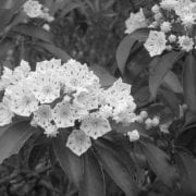
carota), Black-eyed Susan (Rudbeckia hirta), Sweet Fern (Comptonia peregrina) and Milkweed (Asclepias ssp.). With such an abundance of flowers, the Reserve is a great place to enjoy a diversity of butterflies, including skippers, sulphurs, swallowtails and monarchs.

This section of the trail is also top-notch for birding, especially during the spring and fall migrations. Depending on the time of year, visitors can expect to see and/or hear any number of raptors, warblers, woodpeckers, sparrows and other songbirds, including American Kestrel, Red-tailed Hawk, Eastern Towhee, Brown Thrasher, Yellow Warbler, Prairie Warbler, Song Sparrow and Northern Flicker. In addition to the birds and butterflies, keep an eye out for island wildlife, such as box turtles, mink and white-tailed deer. As you approach the final few Discovery Stops you will find the last major habitat along the SGH, the uncommon pine barrens, dominated by Pitch Pine (Pinus rigida). This habitat, rapidly overgrown by deciduous trees such as oaks and a variety of shrubs, is maintained on a rotating basis by Reserve staff through a series of prescribed fires. As you pass the pine barren habitat, you will turn back onto T-Wharf road, heading south back towards the Bay from where you began.

With plenty of open space to roam as you so choose, Prudence Island and the Self-Guided Hike offer a peaceful place to take a leisurely walk among beautiful coastal scenery nearly any time of the year**. For additional information on the Narragansett Bay National Estuarine Research Reserve, please visit www.nbnerr.org.
*The NBNERR Lab & Learning Center is typically open M-F from 9AM-3PM with additional weekend hours during the summer months.
**Reserve properties are open to bow hunting from mid-October through January. Visitors are welcome but vehicle access is limited on some units and you must wear an appropriate amount of fluorescent orange.

Getting there
Prudence Island is accessible via ferry (vehicles, reservations required, and passengers), departing from Bristol
(www.prudenceferry.com). The NBNERR Lab and Learning Center is located about 3 miles from the ferry dock.

Note
• Bikes are a good way to get around the island, but bear in mind many of the roads have deep ruts and are not well paved. Bikes with thick, wide tires are ideal and bringing a spare is always a good idea.
• There are no overnight accommodations or restaurants, but there is a small general store at the ferry landing at Homestead.
• The only public restrooms on the island are located at the NBNERR headquarters (typically open Monday through Friday, 9 am to 3 pm). There is a composting toilet at the south end near the T-wharf.
• Boats are permitted 10 minute live docking at state docks, but aside from that there are no public docking options.
• Ticks are present and in relatively high quantities. It is wise to stay out of any tall grasses and conduct a thorough tick check after your visit.